Hiking (almost) solo in the Arctic Circle from Nikkaluokta to Kebnekaise, tallest mountain in Sweden, in late summer. A few bad decisions, a few good ones, a sufficient recipe for an adventure across deep grassy valleys and snow capped peaks.
Something about the Kungsleden (the Royal Trail) really drew me in, and I knew from the first time I read about it/ saw photos of it that it was a matter of time before I did it. After a few months of deliberation between a Kungsleden/ Swedish Lapland/ Stockholm trip and a couple other destinations (while juggling work and other stuff), I thought this couldn’t wait any longer, and a few weeks after making the decision, I was on my way.
The next few posts are on a week long hike from Nikkaluokta to Abisko via the Kungsleden, with detours to Kebnekaise and Tarfala. But first, the hike to Kebnekaise, the first two days of the week long adventure.
September 2nd, 2016
I felt a sudden calm, a drowning of the swirling voices and noises, as I stepped passed the automated clearance gates at Changi. After a really good first year at work, I was finally back on a solo trip. It hadn’t been a good week though, screwing a couple of stuff up (which hadn’t happened often in the past year). I was just relieved to put it all behind me for the next two weeks. Shut my laptop, grabbed my backpack from the office library, and not long after, up in the air.
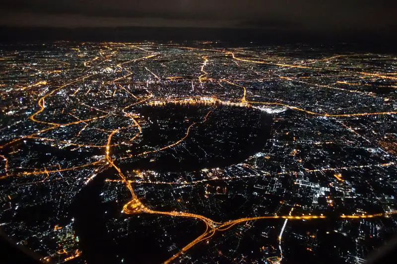
I made a stop at Bangkok (Thai Airways) and caught a beautiful sight as the plane departed. A comfortable 10 hour flight with the row of 3 seats to myself, and pretty decent food. Next stop, Stockholm. Always amazing to see how everything runs like clockwork once the plane rolls in, vehicles lining up, people getting about and all. An hour later, crossing the Arctic Circle, over the Swedish Lapland, as the plane prepares to land.

Bangkok from the sky. The SAS plane to Kiruna, at Stockholm Arlanda Airport. The mountains in the distance was to be home for the next week.


Slightly over 24 hours since I left the office, I arrived in Kiruna. Can’t really find the words to describe, but despite having been on a couple of solo trips over the past few years, the same feeling returns every time reality sinks in that I’m all alone again. A little liberation, a little fear, a little elation, a tinge of sadness. That description doesn’t really do it justice though, it’s a complex mix of emotions. A complicated relationship with myself, that brings me back every time. A different place physically, but a similar one spiritually.
Day 1: Hiking from Nikkaluokta to Kebnekaise Fjällstation
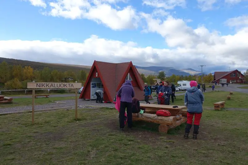
After a night in Kiruna at a comfortable hostel. I woke up early and took the first bus (#92, 09:50 am) to Nikkaluokta, where many people end their hike (but I was to begin mine). The Kungsleden is a very long trail (440km), and most people keep to the northernmost section, between Abisko and Nikkaluokta, presumably the more manageable portion of the trail.
The scenery along the bus ride gave some indication of what was to come:
As usual, I fell asleep on the bus and missed most of it, despite being a relatively short ride of about an hour.
First steps
Where the bus stopped at Nikkaluokta, and where the trail began. The section from Nikkaluokta to Kebnekaise is not officially on the Kungsleden though, but commonly used by hikers (in the opposite direction). Onward to Kebnekaise.
No more buildings and city stuff, just a couple of huts and lots of hikers eager to return to civilization (by bus, twice a day). Where the trail began. At the lower altitudes, trees still grew, lining the trail perfectly.

There were some, but not many, hikers in the same direction as me that day.
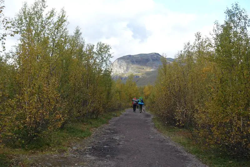
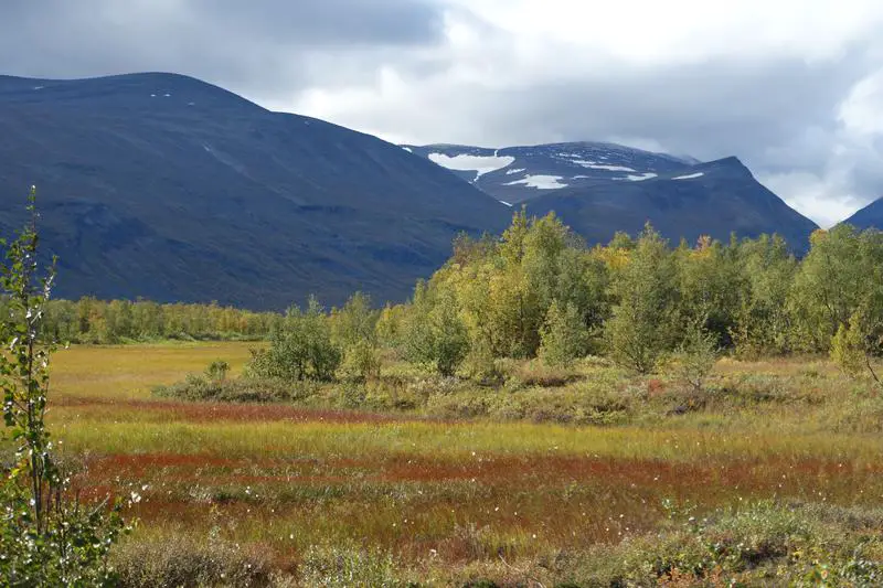
Crossing the river over a small suspension bridge. Bridges were built across most of the water crossing along the popular trails. Towering mountains, glacier fed rivers, trees in autumn, and not a soul in sight.


This wasn’t high in altitude, but high in latitude. Here, north of the Arctic Circle, the tree line is low, and shorter mountains remain bare despite their relatively low height. A few hours later, caught sight of the start of the dense peaks that cover most of the main trail, although the trail goes mostly along valleys thus minimizing vertical gain.

Not quite deep in nature yet, but the feelings that comes with being within nature were starting to settle in. Not easy to describe them, but a large part of being out there, possibly even larger than the scenery, is the emotions that come with it. It becomes easy to feel so small, so insignificant and powerless, yet so empowered and inspired.
Approaching gentle giants
It wasn’t autumn yet, and these peaks were probably below 2,000m. Yet, large patches of snow remain, something I should have taken note before embarking on my itinerary for the following day. The trail on the first day was mostly comfortable, over dirt tracks and wooden plank paths. The trails over the rest of the week though, were quite different.
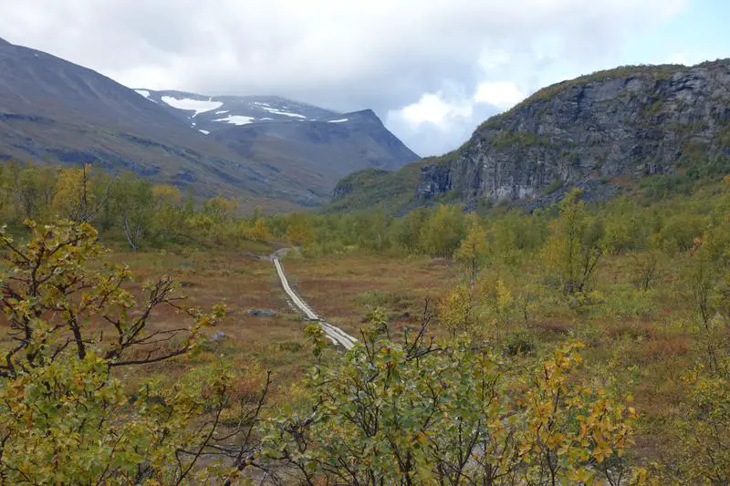
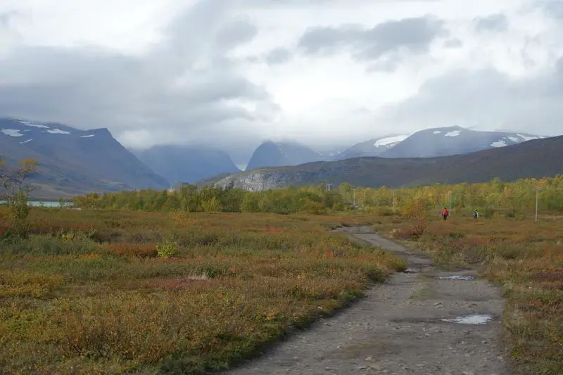
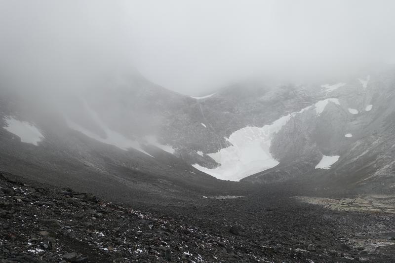
The majestic peaks welcoming hikers to the Swedish Lapland, one of Europe’s last true wilderness. Not too sure which one is Kebnekaise though. Probably the one on the extreme right. 17km down, 2 to go. At the second suspension bridge, also the junction leading to Tarfala, where I was to be headed in 2 days.
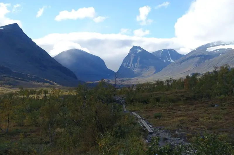

The bridge over a fast moving river that is also the outlet of the glacier lake at Tarfala valley. The high volume of water rushing through the narrow gap has carved a deep and steep waterway into the rocks. Not that pretty. As the trail climbed, the trees got thinner, the earth face rawer, and the mountain peaks closer.


Blueberry fields forever
Having been accustomed to seeing these little jewels in small plastic boxes in supermarkets, I was excited, yet apprehensive, at the find. Can these really be blueberries? There was only one way to find out. And soon I was going crazy, hopping over little shrubs, plucking them right off their little branches and popping them straight in. Talk about an over excited city kid. Or cheap thrills. A really cheap one indeed. Had my fill, was reinvigorated, and back on the trail.
As I got to higher ground, just meters off the trail, to get a better shot, I looked down and saw something familiar, yet very much unexpected. I’d never imagine ever eating wild blueberries right off their bushes.


Found out the next day that blueberries, lingonberries, and a few other species of berries are common in the wild in Sweden, and the Swedes don’t pay much attention to them. Nonetheless amazing to me.
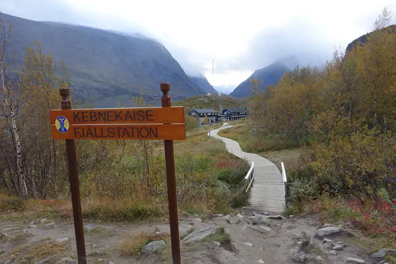
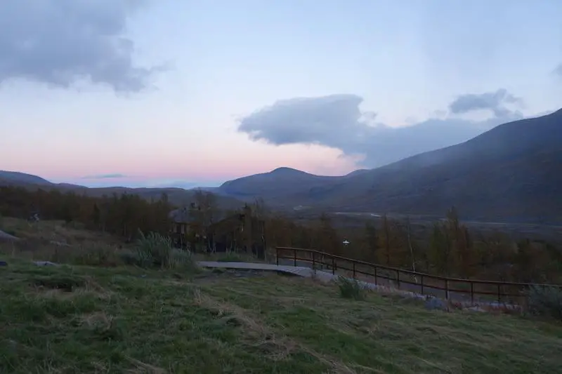
Kebnekaise Fjällstation
After a slow 6 hr walk, I arrived at my first stop of the hike, Kebnekaise Fjällstation, a fully equipped mountain station 19km from Nikkaluokta (the nearest road connection). I was tired, relieved, and also really happy and having made it there safely. I decided to stay 2 nights in the dorm here. It was kinda expensive though at 595 SEK a night with STF membership (295 SEK for a 100 SEK discount per night at the mountain cabins and some hostels in the city I think). But I guess a reasonable price to pay for having all the comforts of a regular hostel deep in the mountains.
It wasn’t too hard a hike for the day, but nevertheless really happy at seeing this sign, and the cabins behind. Settled in and caught sunset over the mountains from the mountain station.
Day 2: Kebnekaise summit attempt
The next morning, outside the kitchen:
After reading online a couple of accounts of hikers making their way to the summit, I thought I should check it out too. Thought it couldn’t be any bad. After all, summer was not yet over, and the peak is just over 2,000m. I had made it to almost 4,000m a few times before and felt confident. Just a few points I had missed out though.
As a precaution, I checked with the staff of stuff I should take note of for my day hike (9 km each direction). For starters, I was warned that there might be some wind, or some snow, along the way. I hadn’t seen snow since Switzerland over 2 years ago, so I thought, why not. My boots, too, were probably more suited for the city and ill suited for any rough terrain (the main Kungsleden trail would have been fine though). Finally, I was told that it is (and probably always will be) rather dangerous right at the summit, with frozen ground at the top and steep drops on either side. Thought I’d give up on the highest point, but I’ll still go to where the ground wasn’t frozen, just to take a look. So, not being really smart, despite having checked with the experts, I decided to go ahead.
Down the valley
The first indication that it wasn’t to be a smooth sailing hiking like the previous day was the howling wind roaring through the valley. The sky looked fine, deceptively fine of what the wind was warning of.
Oh look, blue skies!
Early morning near Kebnekaise Fjällstation, sun slowly rising over the Swedish Lapland. Some cloud cover over peaks near Kebnekaise, but weather still look decent.


A few hundred meters later, the story changed, though. The sun was gone, but the wind still howling, I started to feel apprehensive.
A wall of a mountain, south of Kebnekaise. Ominous low clouds.

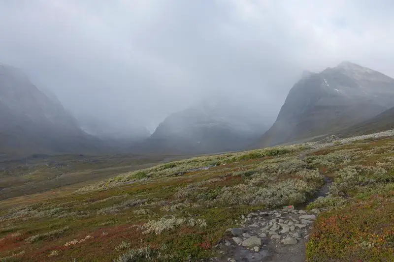
Leaving the valley
Leaving the green valley for the barren trail through the mountains. The valley was fast disappearing behind the thickening clouds, just as I was slowly stepping away from them.
The next sign that there was more waiting for me behind the mountains, were the huge blocks of compressed snow/ ice, not long after leaving the main valley for the higher trail. I doubt I was above 1km then, yet it was cold enough for the ice to last the entire summer. I’m obviously not quick minded enough and need more than a couple of reminders that I was north of the Arctic Circle.
Where little grew and grew little. Leaving the warmth of the valley for the frosty mountain tops.


Dripping ice. Then it started to look scarier.


Partially frozen streams. It was actually quite cool seeing blobs of water finding their way under the layer of ice. Flimsy looking bridge crossing a fast moving stream from the mountain tops.


Towards the unknown
Couple of steps later, I turned back, and realized I could no longer see the valley. I was all alone, at the mercy of nature. Took a deep breath, hoped for the best, and trudged on. The peaks which I was to surmount, totally covered by clouds.

Walking alongside an ice sheet. Wouldn’t have been nice to slip on them, as they go down a long long way, ending on huge, sharp rocks. After getting around the ice sheet, I literally went whatthefuck when I saw this, absolutely no idea what I was walking into, as snow started to fall, gradually heavier, and the wind still not hoarse from all that howling.


As I neared the top of the first peak to cross, the snow got really heavy, and visibility really poor. Wasn’t fear like anything I’ve felt before, being alone, ill prepared, in freezing temperatures, with nowhere safe I could run to, or anyone to call out to. Didn’t know what possessed me to keep going.
Well at least I could see far enough to find the markers, red paint marks on the rocks to show the way. It was quite steep, and if I fell … I can’t even see where I would end up. Here’s a shot looking back down during a snickers break. At the top of the first peak, where I wasn’t even sure if it was what it was. Everything was so white, I wouldn’t have been surprised to see a PAP branch office here.

The only indication I got that it was the top, were the many cairns left behind by hikers covering a large area further in from the trail leading up to the peak.
A brief respite
Just for a moment, the clouds cleared abit, and I found myself staring right in the face of the majestic Kebnekaise. Stood in awe for moments, took another deep breath, and carried on towards the final objective. The calming weather helped to soothe my nerves a little.
Still not a human in sight. The last hiker I passed was hours ago, just after the grassy valley. Down all the way, up all the way.


Didn’t look that far off, but nearing the edge, it became clear that it was THAT far off. A trip to the bottom (a few hundred meters of near vertical descent), and up (another few hundred meters of near vertical ascent) again. For whatever that awaits.
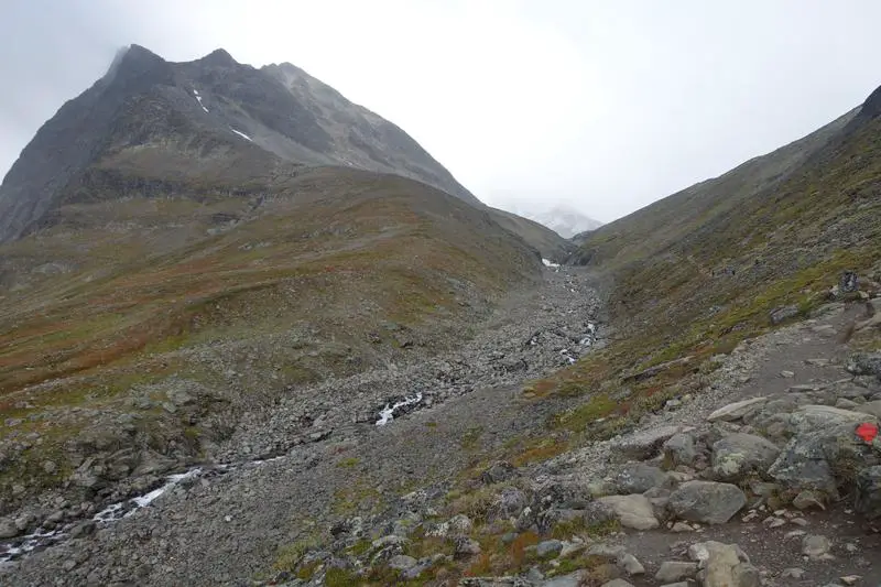
At the bottom of the little barren rocky valley between the two peaks:
A vertical version of water blobs flowing behind a layer of ice (clearer on the left side). Mesmerizing.
The final ascent
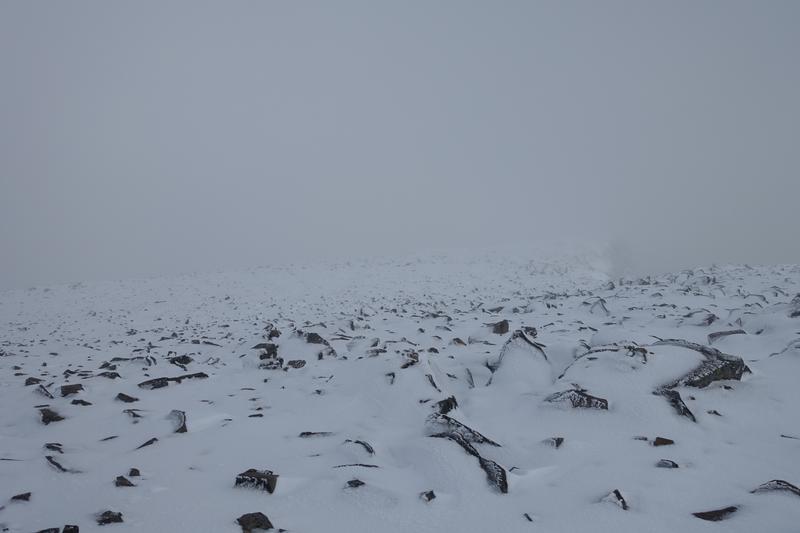
On the way up the final ascent, I finally met some guys (which was nice), and they warned of danger ahead (which was not so nice), as the snow was piling thicker, and the markers might no longer be visible. True enough, it happened, as the heavy snow and wind started again. The markers disappeared under the snow, I lost the trail, and with every step I took, my leg sunk till almost my hip, as I could no longer make out where was snow or ground.
I thought I couldn’t get more terrified than I was at the previous peak, but at that moment I honestly thought that was a real possibility of me dying up there being undiscovered by anyone till maybe a day later, as I didn’t know if there was anyone still hiking after me. I couldn’t shrug off that possibility, but my gut got the better of me as I struggled upward, keeping in the same direction. Didn’t take any pictures on the way though, was too busy trying to stay alive and not twist or break my leg while not straying too far off the imaginary course (since I couldn’t see where I was going).
Top of the world
After what felt like hours, I saw markers again, this time vertical poles, and I knew I was near the top. The snow had stopped falling, the sky had cleared a little again, but the snow was thick as ever. I saw a cabin in the distance, and tried to pick up my pace. Maybe I’d be able to find someone whom I could follow down, at least not dying undiscovered. The snow was so thick that I had abandoned any attempt to find or identify the summit (which I found out later was probably 100 or 200m away, not that it would change my mind, it was impossible to walk in the soft, thick snow).
Outside the first cabin.

I arrived at the cabin to find it abandoned and deserted, with nothing inside. I went out, looked further along the vertical markers, and spotted another cabin in the distance. Could that be it? Again I took as quick a step as I could, towards the next cabin. Alas, it, too, was deserted. The weather was calm, but I was getting more and more afraid. Thinking about going back the whole same way down alone in that weather didn’t feel the very bit comfortable.
I took a break in the second cabin, contemplating my options. Picked up an extra glove somebody left behind in the cabin. In the morning, I remembered I saw there were two trails to the top. An easier one and a difficult one. I thought the one I took was so tough, it had to be the tougher one, and decided that I would try to find the other trail down. Put on my stuff, and stepped out into the blinding sunlight.
Making my way down(town)
As I was nearing the first cabin I passed, I finally saw hikers (another couple of hours after I last saw the hikers going down Kebnekaise), and was literally overjoyed. I hadn’t been happier to see a human being I swear, and there were four of them. I waved eagerly. Or perhaps desperately. They waved back, perhaps looking a little puzzled as to why someone would be waving to them so frantically. They too, decided not to head to the summit, but to take a break at the cabin before heading down. I asked if I could join, and they warmly welcomed me to.
With lips turning numb, I could barely speak, but was really, really relieved. And with good reason to too, as I found out later the trail I came up by was the easier one, and if I had attempted to find another trail I’d probably get lost in the mountains with no way of getting any help. That was quite definitely, a definite death. For the first time in a few hours, I felt certain that I was NOT going to die.
Views from Kebnekaise
Felt at ease enough to start taking photos and videos again. Here’s just outside the first cabin, just before starting to make my down following two of the four friendly hikers I met at the cabin. The other two still resting awhile more.
On the near vertical part of the trail down the peak:
Kebnekaise and the surrounding area is so much easier to appreciate without all that snow and wind and clouds.
Out of this world. 
The little space between the peaks that looked so horrible earlier.


And before I knew it, we crossed the other peak, meaning that there were no more ascents between us and the mountain station. Hooray!
A glimpse over the lush lower valleys. On the edge (of desire). It’s going down (I’m yelling timber).


Sometimes I need a little reminder that some things are best enjoyed shared.
Almost back in the valley!
Everything that looked familiar, felt good. Last look at the mountains and their frozen hearts.


Back in the valley
Much nicer weather in the valley than in the morning waiting for us.
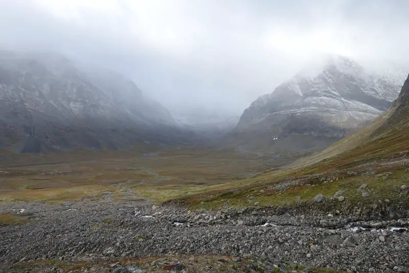
Didn’t know then that I would be back in this valley in 3 days, no thanks to some less than desirable conditions on the trail near Tarfala.
Beautiful valley, unobscured by the clouds that hid it earlier that day. At the entrance to the mountains, same spot I took an earlier shot.


The rest of the way was much more comfortable, and my lips were less numb. I had a nice exchange with the two Swedish hikers whom I followed down Kebnekaise, and was extremely thankful of the warmth they extended to this lone crazy Asian in the mountains. Before we knew it, the mountain station came into view, and we bade farewell, agreeing to meet later in the night after dinner at the lounge. It was still chilly, but I was feeling all warm inside.
Back at Kebnekaise mountain station, at last.

That night, on the way to the shower, not sure why but I decided to turn back and look up into the sky. And there it was, a magical green streak across the vast dark sky. “Is … is that the Aurora?” I asked an experienced looking guy standing outside the cabin. “Yes it is, beautiful as always.” And that was my first experience with the Northern Lights. Stood there for awhile, clutching my toiletries while staring open jawed at the elusive lights (had made a trip to Iceland 3 years ago without any luck with the lights).
Aurora Borealis from Kebnekaise Fjällstation
I thought I’d quickly wash up and try to get some shots, but by the time I was out, the aurora had mostly dimmed. Decided to try my luck anyway. The lights from the cabin made it slightly more complicated. Not that I mind, though, if anyone was ever still lost out there at this time, the bright lights from the cabin might be the only way to safety, and I might very well have been one of those if not of some luck I had and angels I met. Moving a little further from the buildings reduced the impact of the lights on the shots drastically.
I soon found out, that the lights, very much like stars, could be captured on camera with long exposure, even if they were very faint and hardly visible (with a decent camera). So then began the estimation game, estimating camera settings and direction to point the lens at. Wasn’t perfect, but I was happy with my first ever Northern Lights photography session. Here are three of the shots taken that day, with the colors slightly adjusted to bring out the lights a little more. Not really experienced with photo editing so these were just basic edits to the balance and contrasts, no additional details added. The other photos above (non Northern Lights shots) are straight from the camera though.
Shooting stars and dancing lights. Northern Lights over the mountains as seen from Kebnekaise Fjällstation. Aurora Borealis over the mountain station.
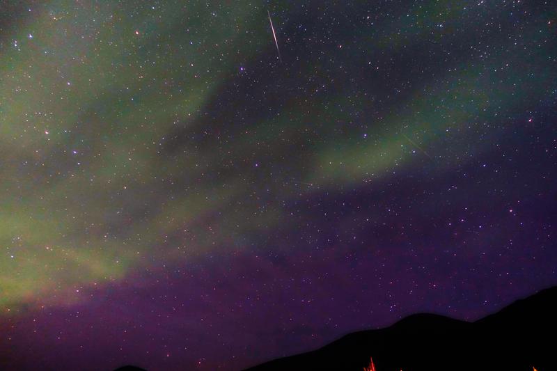


I’d imagine that the Aurora Borealis/ Northern Lights from Kebnekaise Fjällstation might be even more amazing with better weather conditions, but that was amazing enough for my first ever experience with it.
Kebnekaise round up
It was a day that nearly went all horribly wrong, but ended in almost the best possible way. Looking back, it was really foolish of me to attempt the climb alone without proper equipment and experience, and I would definitely advise anyone against doing what I had. Glad to have my life back. I went to bed feeling great, all ready for the next adventure, from Kebnekaise Fjällstation to the mysterious Tarfala Valley the next day.


Pingback: Travel and thankfulness go hand in hand! What makes a thankful traveler?
Hey Aaron! I found your site after reading the collab with Gypsy With A Day Job on being thankful! I think it’s cool seeing a person of color (esp. an Asian) travel blogger since there doesn’t seem to be many of us!
Hi Trang! Yup it’s cool to see other Asian travel bloggers around 🙂 Looking forward to see our blogs grow!
Hi Aaron
Thanks for your information provided. I’ve read your article regarding the Kungslefen trial and summitting Kebnekaise.
I’ve decided to do the trial of Abisko-Nikkaluokta with my wife for this coming early September, which thus passing Kebnekaise mountain station at almost the end. I am just wondering if I decide to summit Kebnekaise, do I possibly needed a guide. If yes, how much would I need per person?
Second question is what would be the weather like in September (including the Kungsleden trial + the Kebnekaise summit) ?
Hi Jeffrey,
It is possible to do it without a guide, especially in good weather. However it is a good idea to get a guide as weather can be less predictable at the top. I am not sure about the prices though, I think you’ll be able to get a quote from the Swedish Tourist Association customer service here: https://www.swedishtouristassociation.com/about-stf/customer-service/
I’m not sure how the weather will be like this year given my limited experience, but during my trip in mid September there was alot of snow on Kebnekaise, making climbing it alone dangerous. The weather on the main trail was generally nice though, other than strong winds at some parts. Looking at the current forecast there seems to be a high chance of rain on the first 2 weeks of September. It’ll be getting cold, most probably won’t snow (on the Kungsleden), but as for accurate daily weather conditions it’ll be better to check close to the travel dates. If you’re doing the side trips to higher terrain (Tarfala, Kebnekaise), the chance of snow is much higher.
Enjoy your hike!
Aaron
I stumbled upon this post by accident as I was searching for temperature ranges on the peak of Kebenekaise. Mesmerizing story and your writing style with the accompanying pictures are superb. Thanks for sharing!
While being a swede, I’ve yet to take steps upon the mountain but will follow your footsteps on a solo journey in the coming days. Peak season and prices at the mountain station has since your journey at least doubled due to demand, but the experience with the midnight sun and beautiful scenery should be worth it.
I see you’ve kept up with your adventures and am looking forward to reading the other stories. Keep doing what you’re doing and all the best!
Thank you for your encouraging words, Roy! I hope you’ll have an amazing time there 🙂