A 5 day solo trek in Kyrgyzstan in the spectacular Tian Shan mountains, across idyllic mountain valleys, over snow covered mountain passes, and passing the magical alpine lake, Ala-Kul. Itinerary: Jeti Oguz – Teleti Pass – Karakol Valley – Ala-Kul – Altyn Arashan. Truly unforgettable landscapes and an experience like no other.
The main reason I did this trip to Central Asia was for a trek in the Tian Shan mountains, the scenery having left a deep impression ever since the tourism board of Kyrgyzstan got more than a handful of bloggers to write about the region and left stunning pictures splattered all over my Facebook and Instagram feeds. I had been looking forward to the Switzerland/New Zealand/Patagonia of Central Asia. That costs were a fraction of its comparisons were a big bonus.
Continuing where I left off at Bishkek, I took a mashrutka and ended up in Karakol 5 hours later. Spent the rest of day preparing for the trek and got up the next day raring to go. More details on preparing for a Tian Shan trek from Karakol in the next post! There was a small hiccup, as the day I arrived in Karakol was a public holiday and the tourist office, as well as most of the market, was closed. Nonetheless, I got all I needed and woke up the next morning all ready to go!
Day 1: Jeti Oguz Kurot to Jeti Oguz Valley
Finding transport from Karakol to the trail head at Jeti Oguz Kurot
The street to the main bazaar was packed, with cars on either side and taxi touts calling out. I was determined to find the public bus that Aidar from Ecotrek had told me I could find at the bus stop at the southern corner of the main bazaar, junction of Torgoeva Street and Aldasheva Street. If you have Maps.me, it is the bus stop in Karakol labelled Jeti Uguz Kurot.
To my dismay, there were no buses to Jeti Oguz Kurot in sight at the bus stop, and stopping at that corner was an invitation for a tout to corner me. He started at 500 som, but I was still hopeful for the bus. The price edged downwards as I held my ground.
After some time (probably not too long after, as I’m not particularly patient), I was on the verge of giving in and decided to give a call to Rakhat from Destination Karakol to check if what the tout had insisted on about the bus coming a few hours later might be correct, and if the price was reasonable. After all these trips I couldn’t help being slightly paranoid about such transport touts and was thankful for the tourist office for being able to help in such situations.
Giving in
Turned out it might be possible that the next bus would take hours to arrive, and that the price of the ride is likely to be in that range given that I was alone in intending to get to the sanatorium (kurot). It was getting late in the morning and I didn’t want to delay my trek any further too, and the math finally got to me that it actually didn’t cost that much in dollars. If you’re having this option you should never have to pay more than what I paid and should be able to get a much better bargain especially if you’re traveling in a group.
“300 som.”
“350, kurot.”
“Okay let’s go.”
I was ushered into a car of seniors getting to Jeti Oguz village (couple of kilometers before the kurot, where the paved road ends).
Car ride from Karakol to Jeti Oguz Kurot
The other passengers were friendly and tried to communicate with me with little success, given the lack of a common language. It was fun though. The driver didn’t speak much and had a fierce look, or what we might call an RBF, so I was slightly terrified being alone with him in the car after the other passengers got off at Jeti Oguz village.
The Broken Heart
We drove down the road across flat plains, leaving the village for the soaring mountains. The driver suddenly got animated as he pointed towards a huge rock, split right down the middle. He pointed towards his chest and gestured wildly, and it took me awhile to figure he was trying to tell me it was the ‘Broken Heart’, which fortunately I had read about as one of the landmarks in Jeti Oguz. He stopped for me to get a couple of pictures and slowed as we got close. Didn’t look so fierce after all.
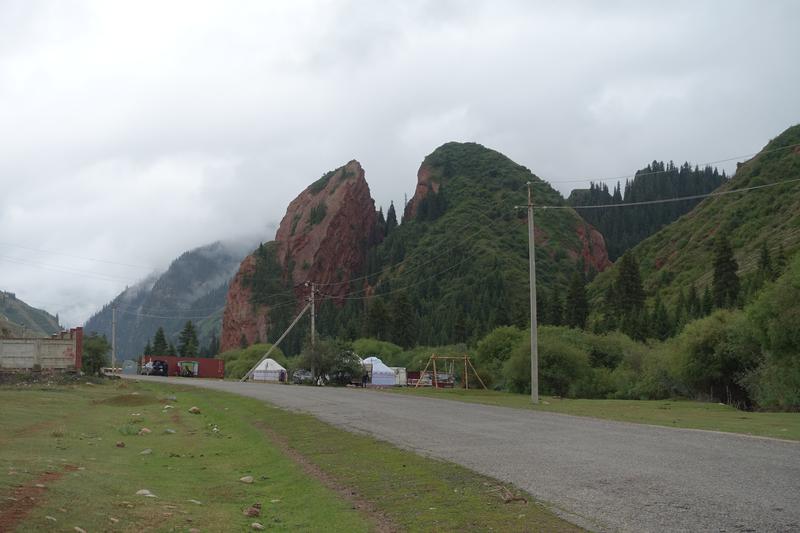
Jeti Oguz Kurot
Finally, we arrived at the end of the paved road, where there was sort of a mini village around the sanatorium, and where it might be possible to stay for the night with a view of the legendary seven bulls of Jeti Oguz. I had plans for the day though, and had to get going. The driver (who suddenly looked much friendlier) helped my bag out of his boot, gave me a firm handshake, and left.
It was as though I had stepped back in time, looking at the cars and houses around. There didn’t seem to be any foreign tourist around at that time. The backdrop of the village, definitely unmissable, are the stunning seven bulls that Jeti Oguz is known for – these dramatic red sandstone cliffs standing out on a hill.

With my heavy pack and long day ahead I decided not to get closer to the seven bulls, and headed for the trail. Facing the end of the road (where the sanatorium is), the path to the trail head is on the left, close but not exactly at the end of the road, beside a restaurant as seen below.

The trail head
From that path beside the restaurant, turn right and follow the path behind the restaurant. Where the buildings end, the raised barrier marks where the adventure begins.

Jeti Oguz Gorge/ Canyon

The trail was through the gorge was wide enough for cars to pass, even as the towering rock face narrowed. Bridges crisscrossed the fast moving stream but the approaching storm clouds meant that the bridges were unlikely to be enough to keep me dry for the day.

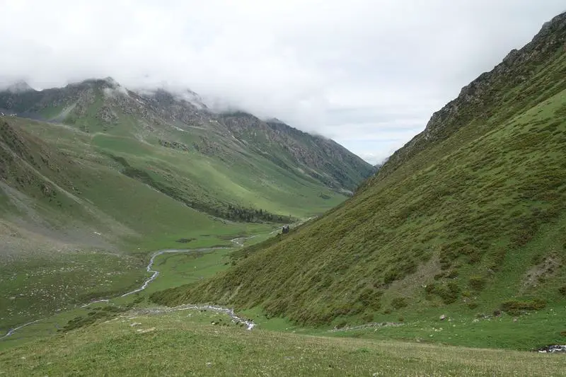
Jeti Oguz Valley
The gorge came to an abrupt end and suddenly opened up to grazing plains where there were yurts, horses and cows dotting the expansive landscape.


A cowherd and what looked like his son were herding cows deeper into the valley. Calfs tried to make a run for it but the little boy was faster, though looking a little helpless when a few made runs in different directions. Eventually they got everyone on their way. From what I understand cowherds bring their cows into the Tian Shan mountains in the summer months to enjoy the fresh mountain grass, and get them out to lower ground in winter.

Pine forests and misty mountains
After a bridge crossing halfway through the plains, there was a fork, and right one is to the left. Pass a couple more yurts and head into the forest again. There were lesser and lesser people as I progressed, still with the occasional car and friendly local gesturing for me to hitch a ride. I politely declined, insistent on doing it the ‘right’ way, though they probably thought it strange for someone to decide to walk with a heavy bag when a ride was offered.

The climb was gentle, but the landscape was changing much faster. A thick fog covered the trees just above, adding a enigmatic feel to the mountains, and somehow being alone made it feel all the more … mysterious.

Nonetheless it was nice having the trail to myself, getting deeper in touch with nature after all the time in the city.

Occasionally the foliage opened to views like this one below, which felt more like a scene from a fairy tale … or horror movie?

The last settlement
Near where a few trails branch out there was a settlement, the first one in hours, and the last one for another day. A wooden shed, a yurt, and a man minding his business.

Across the bridge at the settlement, the trail to keep on is on the left, following the stream/river further upstream. On that trail, the road soon became impassable to traffic. The nice solid ground turned into a slushy muddy trail through dense forests.

There wasn’t much to see in the forest, and the muddy/rocky ground wasn’t the nicest of terrain to walk on. It was getting late in the afternoon, I was getting tired, and couldn’t wait to get out of the forest.

Out of the forst
Occasionally the forests cleared for nice leafy patches. And finally, (probably high enough in altitude), the trees cleared. The wide open grassy fields looked so inviting to camp upon. I had never imagined seeing such beautiful fields in the wild mountains, as the city boy in me thought such short grass could only be maintained on sports fields or golf courses.

Looked more like a maintained garden to me, with the short grass and winding stream.

Done for the day … or not
Finally, I decided upon the spot below to pitch my tent and call it a day. First time ever pitching a tent. The tent was a little floppy but I was tired and didn’t really mind that. Slipped into my sleeping bag and immediately fell asleep.
An hour later, I woke up to whistling outside, and unzipped the tent to a herd of approaching cows. Behind them, 2 cowherds on horses. They gestured if I was alone, and I gestured that I was. They asked if I wanted to join them at their yurt further down the valley. Cold, wet and hungry, I couldn’t pass up on that offer. Screw doing it the ‘right’ way. I had to pack though, so I told them to go ahead first and that I would head over soon.
Not the best time for an adventure
Nightfall was close by the time I was done taking everything down. After the excitement had died down I realised that I may have made a very bad decision. I had no idea exactly where further down they were, who they were, and if I had just passed up a great camping spot for the night. The dimming light and smoky mountains made the potential bad outcomes seem more likely than they should. But I decided to try my luck and push ahead.

Well the dream like scenery did help to distract my worrying mind a bit. In the silence of the mountains your thoughts seem loud. But fast moving waters may help to drown that out a little.

Finally, I saw cows in the distance, and heaved a sigh of relief. One thing I had learnt that day was that there are no wild cows in the mountains. I still couldn’t be sure if they belonged to the cowherds I met earlier, or if their yurt was near, but according to the map I was near the end of the valley and guessed I shouldn’t be too far off.

First night: In a cowherds’ shelter
Taking a close look, the cowherds’ yurt (more of a small shelter than the regular yurt I had in mind) was there in the distance, on the left. The fog grew increasingly dense as I approached, and beyond the fog someone shouted out to me. I looked around, found the bridge to across the stream, and got to the yurt. I was saved. For that night, at least.

Google Translate was not very helpful that night, even with my downloaded Russian translations (no reception out here, and I was glad to have been prepared). Nonetheless, we shared food, photos, and laughs in that small room which was their living room, kitchen, dining room and bedroom. It was barely enough for 3 people yet they had invited me over, and shared their bread, pasta and tea with me. Not sure if I’d ever get such hospitality elsewhere. They even helped me to get my wet stuff dry by placing them around their fireplace.
I was thankful that I was able to share a little of what I had too – electricity from my portable charger to charge their phone, bread and instant coffee. I didn’t have sugar though, an item they seemed to have asked for. It was an unforgettable night, but eventually I couldn’t take it any longer and fell asleep. Dry and warm. Couldn’t ask for more.
Day 2: Teleti Pass to Karakol Valley
Approaching Teleti Pass
The sun was up early and so were we. Outside the yurt, the fog had lightened a little overnight and I was hopeful for better weather. We had breakfast together, I washed up and got ready for another long day ahead.

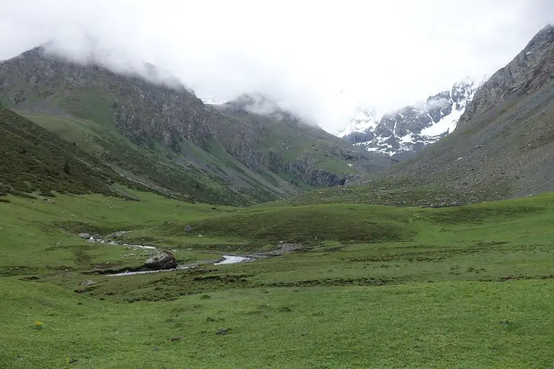
I hadn’t realised how close I was to the snow capped mountains till I got back on to the trail, and with the clearing fog, caught a glimpse of the majestic snow covered mountains that felt close enough to touch. Turned out they were heading in the same direction that day, a little up the Teleti Pass to survey the land and their herd. Difference though, were that they were on horses, and while we left at the same time, they soon disappeared towards the snowy mountains.

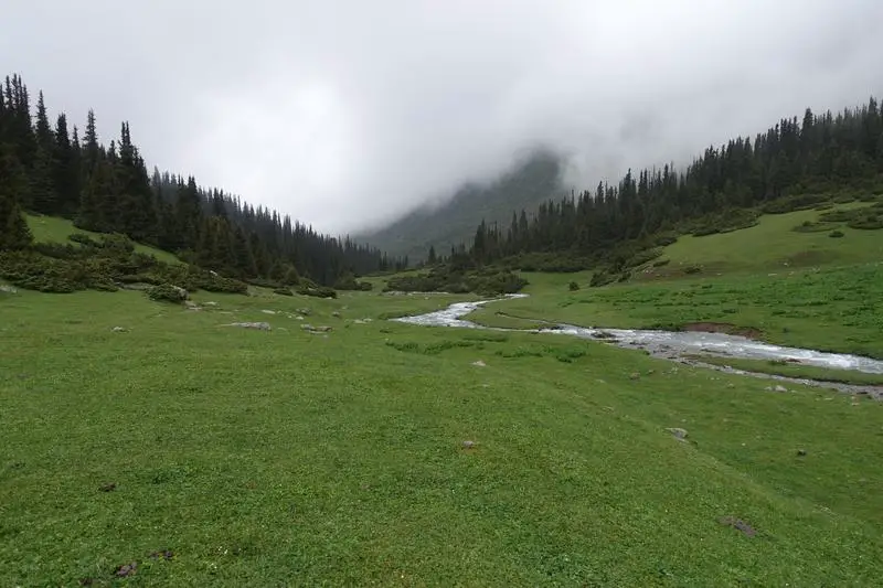
And I was alone again, wandering deeper into the wilderness, in awe of the soaring mountains, perfectly grassed slopes, and weaving streams from gently snow-flaked peaks.
The climb to Teleti Pass
Somewhere along the main valley a stream slipped in from the left. It was time to take the valley to the left, which ascended quickly towards the Teleti Pass. The path was steep, with multiple switchbacks. Every now and then I stopped to catch my breath and a few snaps of the mountains around.

I had underestimated the climb to the Teleti Pass, and it seemed to went on forever. Some respite along the way though, was meeting the cowherds who were done with their work there and heading back. We took some photographs together, said our final goodbyes, and continued on our ways.

With every turn, the valley I came from seemed further away, and further below. The fog was also starting to roll in again.
Up till then the terrain was encouragingly grassy, but this abruptly ended in rocks, snow and ice. Possibly the worst terrain for summer hiking. Flashbacks to the nightmares I had at Kebnekaise and Tarfala in Sweden. There was no turning back, only hope that the pass was near and conditions would get better soon.

Let it snow, let it snow, let it … no …
But it was only the beginning of a few terrifying hours high up in the mountains with declining visibility and dropping temperatures. The snow patches got larger, the snow thicker, and the fog not helping either.

It was Kebnekaise all over again, being alone with close to zero visibility in the snow. Would have been fun if it wasn’t in the mountains, but out here, it was terrifying.

Lunch break in the snow
Despite that scary looking weather, it was neither raining nor snowing yet, a small consolation. I tried to make the best out of the situation by having a hot snack break beside a big rock to cheer myself up. As the water heated up rain started to fall. Can’t get worse, I thought. Then I noticed snow accumulating on my bag. Why now.

I wasn’t about to let that get in the way of my hot snack break, and had some coffee, cereal porridge and biscuits before trudging on. By now the snow was getting heavier and I was concerned about snow prints of the trekker in front being covered, which had been my main source of navigation.

Teleti Pass
Though really terrifying to only be able to navigate by trusting the footsteps of someone ahead, it was also a really interesting experience. I was able to see each step the person took, every misstep, and where the snow was too deep that led to him/her falling over. It was a moment stuck in time. At least till when the snow covers over or when the sun decides it’s finally time for summer.

Finally, after hours of uphill climbs, I stood on a small ridge, where beyond seemed to be downhill. It was the Teleti Pass. Caught my breath, hoped for less snow, took some pictures, and carried on.

The descent was appreciated, but snow noticeably thicker on the other side. I continued following the footsteps (literally) of someone I had never met, which included sliding down the snow for a couple of meters as seen below. I was so worn out and conditioned to follow the steps by then that I had not realised what a dangerous thing I had just did until I got down, where I took that picture below.

More snow ahead, deeper and longer stretches. I could ‘see’ the person who was here a few hours ago struggling with the snow too. It became apparent from the prints that of all the people that had been there that day I was the only one without hiking poles. Not that it mattered much I guess.

Teleti Pass to Karakol Valley
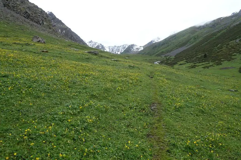
After hours feeling small and terrified at the mercy of the mountains, I got out of the snow, onto a golden carpet of little flowers. On thing to note on getting from the snowy part to the fields, is to stick to the right where applicable, or risk being on the wrong side of the river (when the stream becomes one).
It was late in the afternoon, I was exhausted from walking in the snow, and couldn’t wait to get down to the Karakol Valley to set up camp for the night.

The descend over grassy fields was as comfortable as it could have been that day. Soon the treeline began, and the trail went into pine forests again.


The pine forests also marked where Karakol National Park began. There is supposed to have been an entrance fee and nightly camping fee collected by rangers, but perhaps as I was too early in the season, no one approached me for payment throughout my trek.

Karakol Valley
Near the end of the forest a couple of steep switchbacks brought me down to the valley. Exiting the forest, I saw 3 men in the distance, and waved wildly to them. I was just happy to see people again and picked up my pace to catch up. They were 3 brothers doing the same trek I was on.
So these were the people whose footprints I had been following that day. I asked if I could join them for the night. They were heading towards the yurt camp further down the valley, another 2 kilometers or so more. I had originally planned to just set up my tent when I reach the valley and was near the river, which I was by then. But yurt camp doesn’t sound too bad after an exhausting day with melted snow in my boots. And so we became a party of 4!

The weather was much friendlier as dusk approached. So was the terrain. We had a comfortable stroll along the river, stopping to check out the cows and horses.


It’s amazing how appreciation for the mountains can change with the weather.

With company, everything seemed less scary, even with the last bit of light slipping away before we’ve found the camp. We arrived in the end, with the final rays left.

Second night: In a yurt at Karakol Base Camp
There were a few yurts in the area, mostly catered to tourists. Cold, wet and tired, we approached the first one, where a lady was waiting. 350 som for a place to sleep in the yurt that could probably sleep 6, 400 som if we wanted to have a fire going. It was a no brainer.


After a carbs heavy dinner, I went back to the tent and slept soundly for the night in my sleeping bag. The fire died halfway through the night, the brothers tried to get it up again to no avail. But the roof over our head and 0 degree rated sleeping bags were sufficient.
Day 3: Approaching Ala-Kul
Leaving Karakol Valley
I got out from the yurt the next morning to this view of the Karakol Valley. Nothing short of spectacular.

Some coffee, cereal, and some leftovers from the previous night before getting on my way again.

The first half hour or so was easy, over flat ground moving further out from Karakol Valley. Where there was a stream to cross, we moved further upstream (to the left) till there were logs laid across the stream. As had been for most of the trail, there mostly isn’t a need to get wet over these crossings.

After that crossing, there was an immense rock wall. Looked like a mountain had collapsed or something.

Crossing the small wooden bridge into the forest
And then the second water crossing to get on the other side of the valley. This time there is a bridge across the water into the forest. I think this is also where the trail for the 3 day trek joins the trail for the 5 day trek.

I had one last look at the mesmerizing Karakol Valley on the bridge, before getting into the forest with not much of a view for some time.
A nicer forest
The forest path was much of what you’d expect. I should be grateful that it wasn’t as slushy as the forest trail I did on the first day. There are a couple of forks on the trail but they generally head in the same direction. The general direction to be heading is away from the river, towards the mountains.

Occasionally the path is blocked by fallen comrades of the forest. Usually when that occurs there is an alternative path already trodden nearby.

Not that much of landscapes in the forest, but full of life. Looking down, there were critters of shapes and sizes, and looking up, eagles soaring above the trees.

Couldn’t get a good shot of the huge bird above, which I suppose was a eagle. Some drama going on above the trees, as a raven or some black bird kept disturbing the eagle like creature by following it from tree to tree.

At an opening in the forest, I stopped and looked up. All was quiet, except for birds chirping all along the valley. It was incredibly calming.

The climb to Ala-Kul
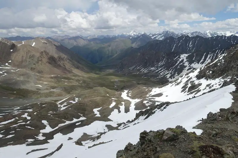
Beyond the forest, I couldn’t help looking back every few steps at the spectacular, ever changing views as the trail climbed higher and higher. The Karakol Valley stretches lengthwise from left to right in the picture below.

At another clearing there were horses about the bushes. Not sure how they got that high up but they seemed a little scared to see me and started moving downhill.

The lush forests gave way to an area covered by huge boulders, which was quite difficult to walk on. As the rocks got bigger it also became harder to figure where the right path was. Often, this can be found through cairns (rock stacks left by trekkers) or by ground covered in smaller rocks, which would indicated somewhere often stepped on by trekkers.

Approaching the first camp
Somewhere along that rocky section there is painting on the rocks indicating the camp ahead where there might be stuff being sold in summer. This was also where the weather took a turn. The relatively hot sunny weather made way for a drizzle, and as I took out my raincoat I noticed the sound of rain changed, looking down to see the ‘raindrops’ bouncing off the ground. I had been warned to prepare for all seasons in a day but hadn’t experienced it till then, where the weather went from sunny to raining to hailing in a matter of minutes.

As fast as it began, the hail stopped and sun got out again. But that cycle went on for much of the afternoon. Closing in on the first campsite, I could see the end of the valley, with a magnificent rock formation rising sharply like a sleeping dragon stirring in its sleep.

Alas, this was all I found at the first camp. There was no one there. Probably too early in the season. The structures look similar to the one I slept in with the cowherds on the first night, without the covers.

The landscape changed as the trail got higher in altitude. Here, just beyond the first campsite, was another garden-like spot. Cute little plants and flowers line the path.

The second camp (Sirota Hut)
Not far from the first campsite is the second, more well known campsite. There is a permanent wooden hut here but likewise deserted in early summer. This is also the final marked campsite before Ala-Kul.

I arrived alone, having separated from the brothers at the wooden bridge as they took a comfortable pace up. I knew that I would meet them again as there was only one way up. As word was going round that the lake Ala-Kul was still frozen, I thought it would be crazy to proceed alone to the next known campsite beside the lake. It was still early in the day (past noon when I reached), and the campsite at the lake was likely the furthest I can reach that day.
So I waited for the brothers at the Sirota Hut to see if they’d want to proceed or call it a day (sounded too early for that though). The Sirota Hut became a meeting point of sorts. For people doing the 3 day trek this is usually the campsite for the first day. I met trekkers heading in both directions, some having turned back at Ala-Kul as the weather had just been too harsh up there that day.

Sirota Hut was shrouded by trees, and with that strong looking wooden hut looked like a comfortable place to spend a cold night (relative to sleeping on open ground).

Sirota Hut to Ala-Kul
The brothers arrived around 2 in the afternoon and the weather looked better then, so we decided to make a push towards Ala-Kul. Though I couldn’t imagine sleeping beside a frozen lake in stormy weather. The cycle of sun rain and hail continued, though it looked less terrifying with good company.

The trail got steeper, narrower and rockier beyond Sirota Hut.


Following the stream to its source, the trail took a right near the rock formation, and that was where things got freezy again. It wasn’t cold (yet), but walls of ice could be seen against the rocks in the distance. The source of this stream, the famous Ala-Kul.

The final stretch was not any easier. The frozen waterfall marking the start of the stream could be seen, but a huge wall of rocks stood in our way.

Third night: Tent beside a frozen waterfall at Ala-Kul
As we got nearer, we saw that a couple had set up camp on a grass patch beside the waterfall. The frozen lake Ala-Kul was just over the waterfall, but this spot sounded more inviting to sleep on than the open surface beside a frozen lake.

So on my first night ever alone in a tent, I camped beside a frozen waterfall at approximately 3,500m. Well not totally alone, the 6 of us formed a small community guarding (or rather, blocking) the way and enthusiastically greeting hikers who had gotten over Ala-Kul and were heading to Sirota Hut. Well I assume they were going to end at Sirota Hut as it was getting late, probably past 5 in the afternoon by the time we got our tents ready.

Turned out the couple had actually reached Ala-Kul but found it too miserable to camp at, even contemplating getting out of the valley without crossing to Altyn Arashan. In the end, they decided to camp at the waterfall and attempt another crossing of the Ala-Kul pass to Altyn Arashan the next day. Sounded like a good decision, as the weather had totally cleared up by that evening. It was a nice evening basking in the warm sun, drying stuff out, cooking dinner in the open, and enjoying sunset.

A cold and starry night
I woke up at 11 to the nightmare of everything freezing up, frost building on the tent, and me getting out of the tent to find no one around. Check on the thermometer said 4 degrees celcius in the tent. Not so bad after all. The 0 degree celcius rated sleeping bag from Decathlon was sufficient. As long as I stayed in it. But I had to pee.

I tried to hold it back in and went back to sleep, but an hour later I couldn’t take it any longer and gingerly unzipped the tent. There was a gentle breeze blowing outside, but at that temperature felt nothing like a breeze. In the complete darkness outside was the most beautiful toilet break ever. And since I was out I decided to finally put my tripod to use, which I had lugged around for the past few days but was always too tired to wake up in the middle of the night to use.

Capturing the Milky Way at Ala-Kul
I knew the Milky Way had to be somewhere, but it wasn’t clearly visible so I had to set my camera to long exposure in a few different directions to lock on the Milky Way. The positioning of the Milky Way was perfect, at that time I got up to pee it was just above the frozen waterfall. I had taken pictures of the Milky Way before but never before was I able to see it so clearly in the resulting photograph without editing. Yes, the picture above and below are with absolutely no editing, straight out of the camera!

I shivered each time I waited for the long exposure shot to complete, but at the end, satisfied with the haul, I went back to sleep, feeling stupidly happy with myself for having witnessed all of that. Only possible regret though, was having no one to share that joy with.
Day 4: Ala-Kul to Altyn Arashan
Like the previous days, this morning was beautiful too. Not that I was getting sick of it. Had the usual breakfast for coffee, biscuits and cereal before packing up. It was hard to say goodbye to such a lovely place.
The brothers were still enjoying breakfast in their tent when I was done packing, so I decided to start off first, assuming that I would meet them again later in the day. The couple had gotten up to an early start and had left by then. This was the final strenuous day and I was looking forward to getting it done and enjoying the hot springs at Altyn Arashan at the end of that day.

The trail went by the left of the waterfall, up a near vertical pile of small loose stones. It looked deceptively short, and I took a bit of time to get to the top. Here’s a closer look at the frozen water flows halfway up.

Ala-Kul
After 4 days of trekking, I got my first glimpse of Ala-Kul, what most people come to this part of Kyrgyzstan to see. Most people see it in summer when all has thawed and the water is a magical turquoise, but here it is, surface still frozen, in mid-June.

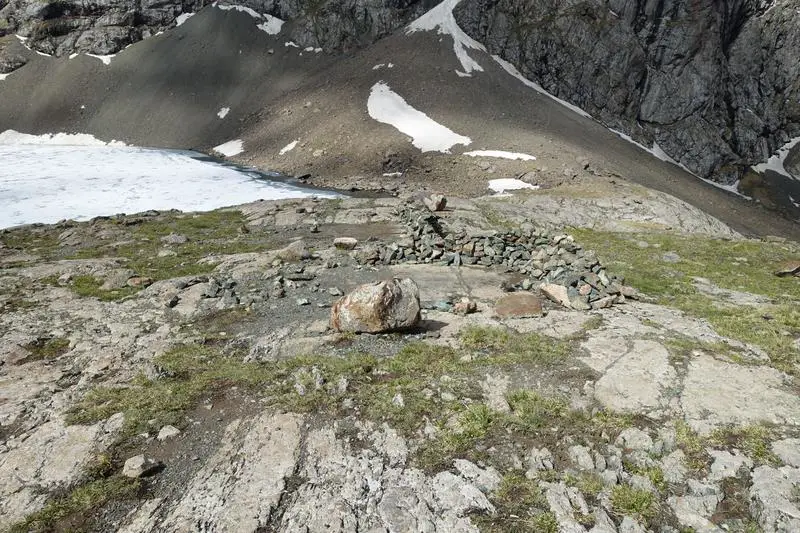
On the near end of the lake there are some camping spots where people have built rock walls to keep out the wind at night. I’d imagine it can get pretty serious.
Couldn’t have ask for better weather that morning. The trail went along the left side of the lake to near the other end, before another sharp ascent to the Ala-Kul pass, highest point of the 5 day trek.

Ala-Kul isn’t a very big lake, but nonetheless a special one, sandwiched between the mountains at 3,500m. After a few turns I could see the end of it. All around were snow covered mountain faces, except for the one I was on. Thankfully.

Finally, the Ala-Kul Pass in sight. it isn’t exactly clear but the trail crosses, somewhere before that sharp point on the ridge. Not to worry about the exact crossing point though, it will be clear once on the ridge so you’ll just need to follow any of the paths leading to the top.

Ala-Kul Pass
After what seemed like hours of non stop uphill climb, I arrived on the top of the Ala-Kul pass, at 3,900, the highest point of my 5 day trek. Literally the top of the world feeling, with snow capped peaks going as far as I could see.


It was a really special feeling standing atop the Ala-Kul pass and getting amazing views all around, all 360 degrees of it. Perhaps even more after that 3.5 day slog to get here.
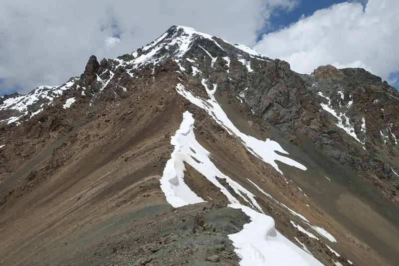
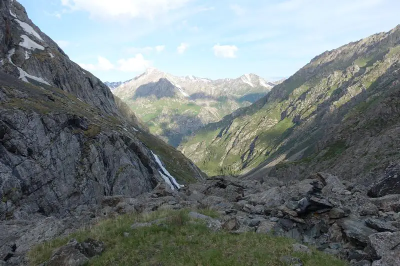
On the other side (the non lake side), the valley leading out to Altyn Arashan. In the distance, even more snow capped peaks.
With the weather (when I reached) and the view, I could stay there all day. I had some tea and biscuits before a slight drizzle started, probably a sign for me to get going.

Descending Ala-Kul Pass
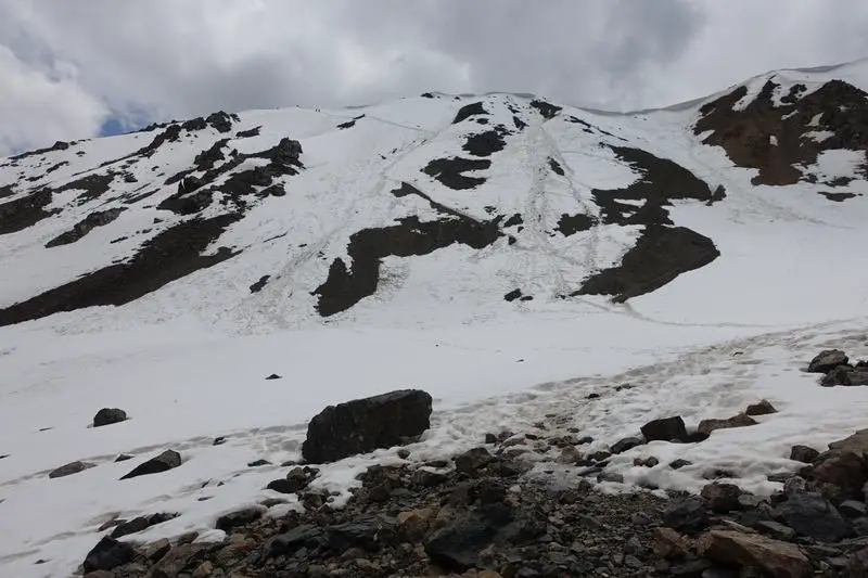
After staying out of the snow for 2 days, it was time to get down and dirty again. While the lake facing side of the pass was snow free, the other face was covered in slightly deep snow. The extremely steep gradient did not help either, but the downhill probably made it a tiny bit less tiring.

The snow was quite thick and judging by the footprints of those before many had fell over multiple times. It got steeper until it was near vertical. Hard enough on loose rock, worse in snow.

Met a couple on Ala-Kul pass who had arrived to the bottom of the pass on the other side by horseback. Here they are carefully getting down the snow covered slopes back to their horses. Definitely not an easy downhill. The only consolation was that the weather held up till I was done.

There were many possible paths down that different groups undertook, but none looked easy.
And back down on solid ground, it is easier to appreciate the beauty of it all. Fortunately or not, that was the last of the snow I had to get over for the rest of the trek.

Keldike Valley
If you’re done for the day after that exhausting conquering of Ala-Kul, there’s a yurt just a little further down (visible from the Ala-Kul pass), and a campsite where you can call it a day. I was determined to get to Altyn Arashan for the hot springs, so I know I had just got started.

Further down the valley there is a larger yurt camp, slightly off the trail and down by the river.

This side of the mountains looked more lively, with tour groups doing day trips from Altyn Arashan to Ala-Kul, which included elderly Korean folks. Here, a group of horsemen were getting out of the valley, presumably having delivered stuff to the yurt camp closest to Ala-Kul.

An animal encounter
On one of the earlier days I had spotted a dog like creature scurrying about the steppes, but it disappeared before I could get a closer look. I was quite certain that it was not a dog though, as like horses and cows, it is unlikely for wild dogs to be up here in the mountains. This time, I spotted a similar creature curiously eyeing the horsemen galloping past. It did not seem in a hurry to hide in its burrow even as I stood at a safe distance observing it. As I learnt latter, this was a marmot, a species of squirrels. Looks so cute here, but apparently a pest in some cases, as some rodents are.

Here it is out of the burrow.

Another horseman along the way was carrying what seemed to be a doorway up. He asked if I needed a lift and I politely declined. But honestly speaking I was tiring fast by then. Here he is posing with his door and horse.

The longest stretch
The nice blue skies were gone and so was my motivation. Each step grew harder in the barren steppes of the valley but I knew I had to push on till the end of the valley.

Another few hours later the trail reached a muddy patch which ended in what seemed like a cowherd’s shelter. This is where the trail crosses the river on to the other side and continues out of the valley. The trail goes behind the shelter (between the shelter and the river). A muddy and messy downhill later there is a shallow stream to cross, which again shouldn’t require getting wet by stepping over stones and picking the right path.


Uphill again for another uneventful stretch towards the next valley seen just ahead in the picture below, the Altyn Arashan valley.


Altyn Arashan Valley
My pace had gotten to a crawl by the time I reached the valley. Glad as I was to be almost at the village, my legs could carry me no faster, so I did my best to enjoy the scenery.

Where the valleys and rivers met there were a few yurts set up. Not sure if they were al for tourists but at least some where. If you had just a little bit of energy left, like I had, just push on a little more and you’ll be at Altyn Arashan.

Couple more streams to cross. Took it a little more carefully with my tired legs this time.

Altyn Arashan
Through the forest once more for about a kilometre or two, and there it was, Altyn Arashan! A couple who had passed me earlier in the forest asked me if I was alright as I was really, really slow by then. With the cabins finally in view I was able to muster the last of my strength for the day to push through the drizzle and get to Altyn Arashan.

There are a couple of guesthouses available at Altyn Arashan, one on the near side (VIP Guest House), and the rest on the other side of the bridge.


Cold, wet and tired, I couldn’t really be bothered to check out the other options and headed for VIP Guest House. Seems like the other trekkers from Ala-Kul might have felt the same too. It was a reunion of sorts as I saw the couple I had just met outside Altyn Arashan, the couple I met on Ala-Kul pass, and the couple from the frozen waterfall the previous night all there.

Fourth Night: In a wooden cabin
VIP Guest House is run by a nice Kyrgyz man and has both yurts as well as bunks in cabins. Having slept in a cowherds’ shelter, a yurt and a tent on the previous nights, I decided to go with the cabin option. There was a fireplace in the room and once it got fired up the room was as comfortable as can be. I took the opportunity to lay out all my wet stuff around it.

I hadn’t had a proper lunch that day and was famished by then fortunately, meals can be bought at VIP Guest House, and I finished every bit of my dinner (300 som).

Later that evening, a friendly guy joined me in the cabin. We hit off really well and ended up meeting up again in Almaty (a story for later). But having my growling stomach filled and wet clothes changed there was one thing left to do at Altyn Arashan.
Altyn Arashan Hot Springs
Each of the guest houses at Altyn Arashan have their own pools filled with hot sulphurous water. All of them are on the other side of the river, which meant that for VIP Guest House I had to cross the bridge to get to their pool. Though I got a little lost halfway and slipped in the mud as it was all dark, the effort was all worth it.

VIP Guest House’s hot spring pool, located in house 6 on the other side of the river (from the guest house), was the perfect way to end a long, cold and tiring day spent trekking. In the cold weather, the water felt really hot, and took awhile to get used to. After relieving all the aching muscles there is a cold shower also in the same building to get washed.

Crossed the bridge once more, and had a really good sleep. The fire died again in the middle of the night and proved impossible to relit, but the blankets provided were sufficient to keep warm (though a cold weather sleeping bag would be better).
Day 5: Back to Karakol via Ak Suu
Around VIP Guest House
As I had arrived late at the guest house the previous night in inclement weather, I hadn’t noticed how beautiful the surroundings were. It was my last morning in the mountains, so I took awhile to soak it in.


Leaving Altyn Arashan
Finally time to leave. Well the views can get slightly similar after many days but I don’t think I’ll get sick of it. At least for awhile.

Across the bridge the mud trail that is wide enough for vehicles begin. Can’t get much easier to follow the way out. I passed a couple more yurt camps and guest houses on the way out.


A couple of Soviet era off-road buses ferrying tourists in as I made my way out. With such a rocky and muddy road it definitely did not look like a comfortable ride. Occasionally these buses tip dangerously to the side as they navigate difficult terrain.

The morning weather was beautiful as usual, and I found myself able to walk much faster than the day before, though some fast trekkers still zoomed past me.

Then the river dropped quickly below while the trail took a more gradual descent. The gap opened up and the trail was soon way above the river.

Altyn Arashan Gorge
I saw a trail all the way below, as well as a cabin and some equipment, and for some reason hoped very hard that that was not the right trail, as it was so far down. And of course, it had to turn out to be, as the trail I was on led to steep switchbacks which went down all the way to that cabin below.

Down at the bottom there was another gateway of sorts.

Not long after, caught up with my friendly roommate and the (also friend) couple from the frozen waterfall. They had left slightly earlier (or me slightly late) and it took awhile for me to catch up.

There was one more bridge to cross. This was where tiny bits of cell reception were picked up. After 5 days without any reception any bit of internet is gold.

The gorge looked similar to the one I entered on the first day, but with good weather everything looked better.


Cell reception
And this was where all cell signal returned. Checking on the news, it was as if we had entered a time warp and returned to a world different from the one we left.

Up next was a small but busy village where there were people sitting along the road. Some offered a ride to Karkaol but we knew the bus stop had to be just ahead and continued.

Very close, but not quite there yet.

Bus back to Karakol
And … we did it! Went it 5 days ago alone and came out with 3 new friends. The mashrutka stops just ahead in the picture before the house (not that mashrutka on the left), on the right side of the road. On Maps.me it is the bus stop at 42.473244, 78.530222


The bus stops near the fork in the road between Ak Suu and Altyn Arashan. If you’re taking the bus to Altyn Arashan you’d also stop at this point and walk the rest of the way in as the bus turns in to Ak Suu. We did not have to wait long for the bus shortly past noon. We managed to get seats but the bus got packed as we continued towards Karakol.

Back in Karakol, we had lunch at the bazaar beside the park with the Monument to Tagay-Biy, where you can taste the interesting local foods of Karakol. One dish you’d definitely have to try in Karakol is Ashlan-fu, a cold noodle dish. It is easy to find in the bazaar here.
Conclusion
And that is it! My first fully equipped multi day trekking trip, though I ended up only camping for one night. The people I met, landscapes I witnessed and weather I experienced made everything complete. The ascents were tough, but none were too long, and the ever changing, spectacular scenery meant something to look forward to and look out for most of the time.
This should be quite a manageable multi day trek for people with not much experience as there are no technical areas (though not that easy too). Probably want to avoid being too early in the season like me though, as the snow can pose some difficulty. More details on preparing for a trek in the Tian Shan mountains here!
")


I have really enjoyed reading this. I will be going there in July and am very excited after reading your experience. Thank you! : )
Hi Heather, thank you for your kind words. Hope you’ll have an amazing time in the breathtaking mountains!
looks really wet. what time of the year did you do the trek?
Hi Kit, I went around mid June last year (started 16th June). Yup weather was not really ideal then.
Hi, thanks so much for this – really enjoyed reading it! We are planning to hike up Ala Kul next week. Would you say it’s sensible when its wet and raining? We have heard its rocky and can be dangerous.
Hi Dee, thank you! Yes it’s probably not a good idea to head up when it’s wet and raining. The trail on either side of the lake is pretty rocky and exposed, and the view is probably not great if it is raining. If it’s raining and you can afford an extra day it may make sense to wait a day at a lower altitude camp before going up to the lake, both for safety and to get a better view. Have a great trip!