The second half of my Overland Track adventure in May 2019. Way better weather than the first half, and we were finally able to experience the stunning Tasmanian wilderness in its full glory.
Previously on the Overland Track …
Day 1 to 3 of the Overland Track. The first 2 days were just wet and miserable, and only due to our waterproof layers and the warm huts at the end of each day were we still coping fine. By the second day we had also somewhat formed an informal group of 6 that were on roughly the same plan, doing a hut a day starting on the same day. Even as we did our hikes in separate groups, at the end of each day we would end up catching up with one another. For those 6 days they were the closest people my hiking buddy and I could have any contact with.
Day 3 came with better weather, but a tough long day with ascents and descents. Day 3 ended at Pelion Hut, set on a scenic spot at the edge of Pelion Plains, where we were able to spot wildlife darting around, close to dusk, against the backdrop of Mt Oakleigh. One small setback though, was that the heater was not working in the hut. With the clouds gone and the hut at the edge of a vast open space, it was a cold night, and I couldn’t be happier for morning to come.
Overland Track Day 4: Pelion Hut to Kia Ora Hut
If sunrise that day was to be an indication of anything, it had to be of the beautiful day that waited ahead. Opening the door of the hut to the veranda facing Pelion Plains, I stopped, and was in awe of the magnificent sight before me.
A thin layer of frost covered the huge buttongrass plains. The peaks in the distance finally appearing distinctly under the spotless sky. Right ahead, Mt Oakleigh’s dramatic jagged silhouette rose up from the plains. Despite having seen most of that the evening before, it was an awe-inspiring experience.

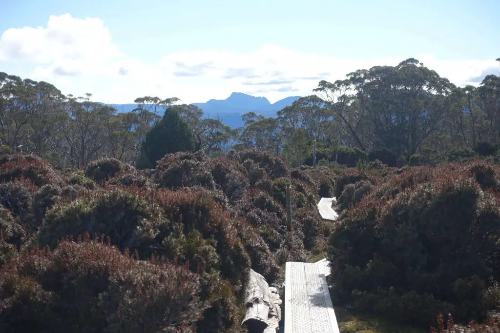
From almost any corner around the compound, there were beautiful views of the buttongrass plains and Mt Oakleigh.


It was hard to say goodbye to Pelion Hut, with that view and the comfortably warm rays of the morning sun. The only thing that made it easier to leave was looking forward better views down the trail that day. There was possibility of climbing Mt Oakleigh from Pelion Hut but as we were slow and daylight hours were shorter in May, we decided to forgo that for Mt Pelion East, the supposedly easier alternative.

Pelion Hut to Pelion Gap
The first stretch was through the rainforest, looking much friendlier in sunny weather than when it was raining. Spotted more pademelons on the way out of the hut, and I’m sure there was plenty more in the bushes and around the trees. The muddy trail climbed gently towards Pelion Gap, and the vegetation started to open.


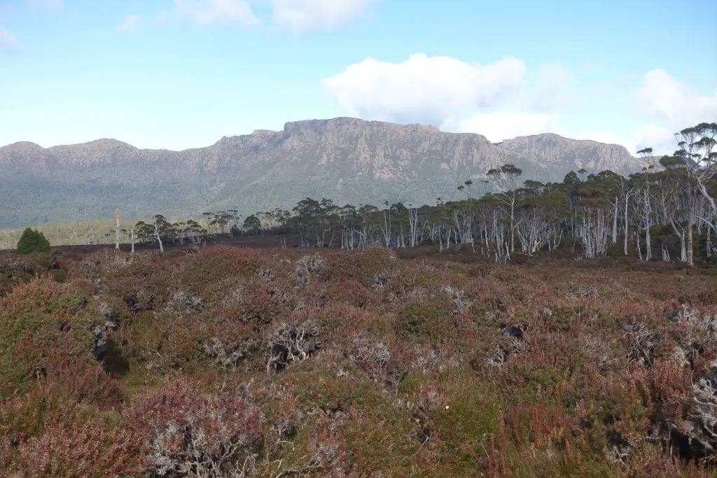
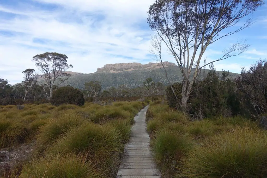
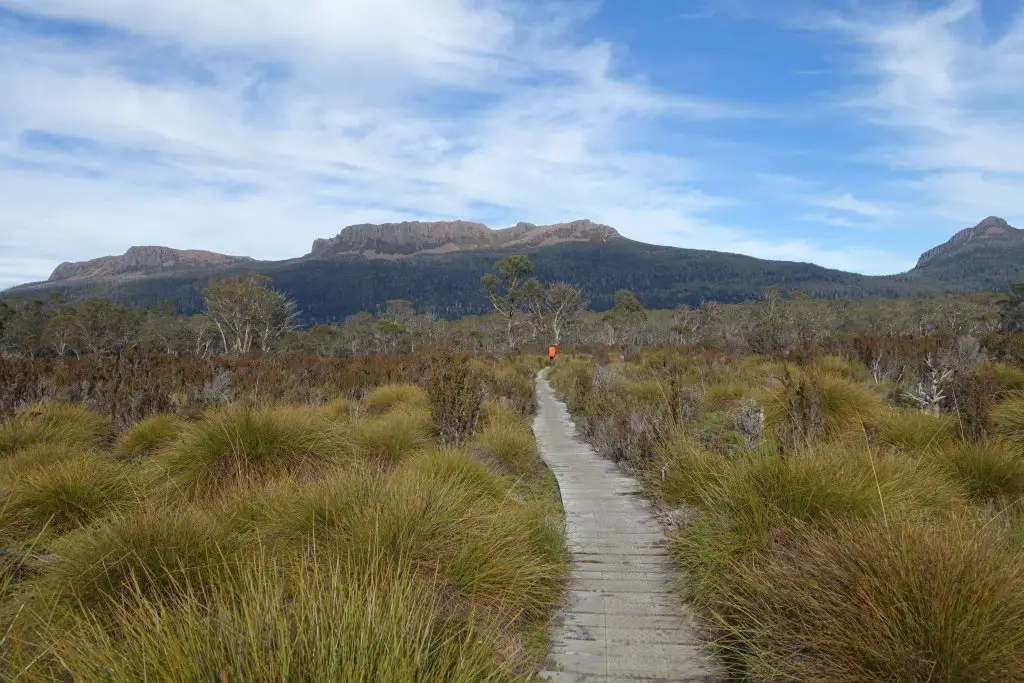
Finally, the trail flattened out onto Pelion Gap, an exposed mountain pass with Mt Pelion East to the left and Mt Ossa to the right. Turning around, I could see all the way back to Cradle Mountain. We tread the foot of Cradle Mountain on the first day but didn’t catch even a glimpse of its summit, with the foggy weather. Finally caught it on the fourth day, and I couldn’t ask for better weather.
Somewhere slightly down Pelion Gap is the junction to Mt Pelion East and Mt Ossa (about 2 hours from Pelion Hut). The left leads up Mt Pelion East and the right to Mt Ossa. With the beautiful weather, we decided to do our first side trip of our Overland Track adventure.
Climbing Mt Pelion East
Not being in such good physical shape we decided on Mt Pelion East, a supposedly more manageable ascent. There’s a wooden platform at the junction, great for a lunch break. We were concerned with time (shorter hours in May) and so got our daypack, secured our bags, and started off. It’s really important to secure your bags, not from people but currawongs, as I thankfully found out later.

The first part was easy, with a constructed path through the trees. Further up construction was still ongoing. Hopefully by the time you’re reading this the path has gone up much further. Without the steps the terrain was quite difficult, as it was steep and muddy. And as the vegetation thinned the trails got less muddy and more rocky. Without the mud it was hard to figure out the trail. Cairns were placed but against the rocky backdrop it’s sometimes hard to discern between a legit cairn and a random pile of rocks.

Took a few wrong turns but it was still manageable to get to the base. What we could not figure was how to get to the top. We got stuck for a bit. In between, a really fast guy came and somehow ran to the top via a route we would never use. Eventually we traced a path following left/ clockwise around the rocky outcrop till it seemed possible to start climbing, and made a scramble to (somewhere near) the top.

Views from Mt Pelion East/ View of Mt Ossa
Probably a little more scary than it was tiring, but glad to have made it to the top, about 2 hours from the junction. From the top of Mt Pelion East there was almost 360 degree views of the surrounding mountains, valleys, and Tasmanian wilderness. It was spellbinding. Of course, the biggest star was Mt Ossa, which stood squarely in front of us. On hindsight Mt Pelion East was a good idea because we would not have that view of Mt Ossa from Mt Ossa. Much like the top of Eiffel Tower isn’t the best place to see Eiffel Tower!


Pelion Gap to Kia Ora Hut
It wasn’t late but signs of sunset were starting to show, so we quickly made our way back down. Going down was way quicker and we took probably about 30 mins to an hour. We could see and hear currawongs circling round where our bags were and started to get worried, despite having secured them. These birds are known to be really crafty. Somehow they knew we were coming and nowhere in sight by the time we reached our packs. True enough, they attempted to undo the zips and even pulled out some of the stuff from one of the side pockets. Probably upon finding out the good stuff was LOCKED away in the main compartment, one of them decided to leave some droppings on my pack. Thanks.

The rest of the day was easy, first flat over duckboard across Pelion Gap, then slightly hilly and muddy terrain for the last stretch before Kia Ora Hut. There are some other buildings/ private lodging before the hut that gave us false hope that we’ve arrived but anyway the destination was just slightly further down the path.

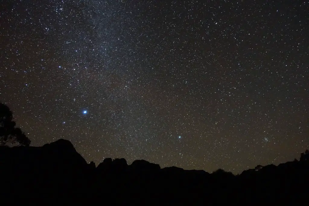
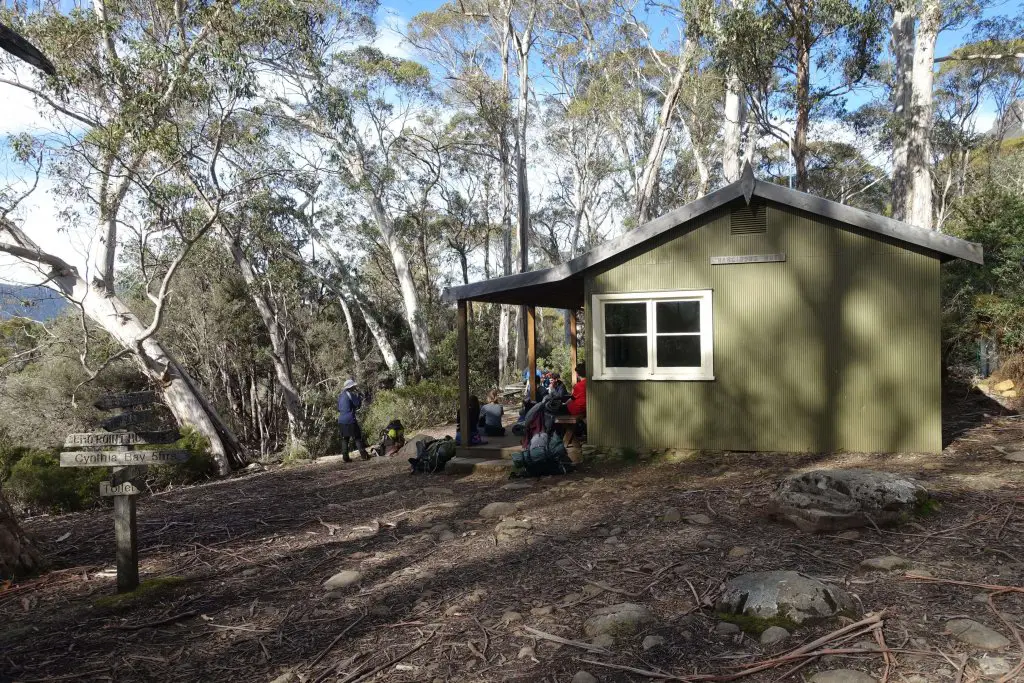
Kia Ora Hut and a sky full of stars
We arrived at Kia Ora Hut just before sunset, 1.5 hours after we picked up our bags at the junction, and as usual the last of the pack. Kia Ora Hut is a small hut that comfortably held the 6 of us (max capacity 20). It’s on days like this that I’m thankful there aren’t many hikers, as it was a cold, cold night and I doubt I’ll enjoy it outdoors. Despite the dropping mercury I couldn’t pass up on a chance to capture some stars with that clear night sky. Braved the temperatures and took awhile to fiddle with the camera, and ended with a shot just above the trees I really liked. With that, done with another beautiful day. Also, thankful for having a working heater in the small hut, definitely warmer than the previous night. All’s warm in the hut. Outside the hut, another story.

Overland Track Day 5: Kia Ora Hut to Windy Ridge/ Bert Nichols Hut
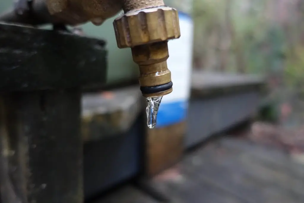
While the skies were getting clearer, the nights were getting colder. The next morning, the taps of the water tanks froze and nothing could get the water flowing. Pouring boiling water, burning gas under the tap, and of course, punching the water tank. So breakfast was made in yellowish water from the nearby creek. Took our time and by the time we were done the sun was shining brightly on the water tank. Decided to give it another go and lo and behold, the water flowed.

Most of the higher altitude terrain was done by the fourth day. The rest of the way was mostly on lower ground through forests. More trees less views, but for today, couple of waterfall side trips.
Du Cane Hut
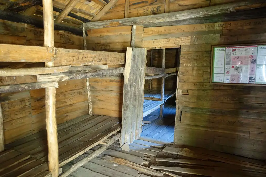
While lacking in views it was still an enjoyable walk through the forests. An hour and a half later we arrived at an opening in the forest where the Du Cane Hut is. Perfect for a short break while reading the information boards in the hut on the history of the area.

D’Alton Falls
Just under an hour down the track from Du Cane Hut, we reached the junction to the first 2 waterfalls of the day, Fergusson Falls and D’Alton Falls. Since weather was good and there was some allowance for the day we decided to head down to the first 2 falls. Left our packs at the junction, got our day packs and headed down the path. The initial part for both waterfalls are the same but they split off after a few minutes, the left to D’Alton Falls and the right to Fergusson Falls. First to D’Alton.

The path was slightly steep and looked like it’ll be really slippery when wet. Any slip ups will probably result in serious injury so we were pretty cautious here.

Another couple of minutes later we came face to face with a huge wall of water. It’s about 15 mins from the junction here. After days of rain the waterfall was roaring so we kept a safe distance. From the usual pictures of D’Alton Falls you’d see some bits of it’s rock face, but not today.


Fergusson Falls
Backtracking a little to the split between D’Alton and Fergusson (there’s a sign) and then another few minutes more through dense vegetation we arrived at Fergusson Falls. (about 10 minutes from D’Alton Falls or probably 5 from the split.) Honestly there isn’t much to see here as the path leads to the side of the waterfall. As with D’Alton Falls, any slip up looks like it’ll be really dangerous. Just a narrow open ledge to take photos from, as with D’Alton Falls.
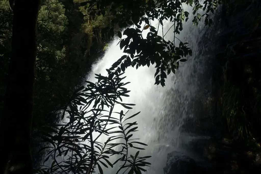


Hartnett Falls
Back from the junction where our packs were waiting, it was another 30 mins down the Overland Track for the junction to Hartnett Falls. Packs went off and down we went. Fortunately we passed hikers who were on the way back up, as they told us it was possible to get to the bottom of the falls as well as to look out for a giant mushroom on the way there.
We might have missed it all if not for that information. About 15 minutes down the trail we were right above Hartnett Falls, and there didn’t seem to be any clear way to continue. With the earlier advice in mind we kept looking, and realized that there a path to the left if we backtracked just a slight bit. Looked like a detour from the falls, but was what took us straight to the giant mushroom and down to the falls.

A flight of really steep steps later we passed the giant mushroom and reached the outflow of Hartnett Falls. It was a beautiful moss garden.

The final stretch from the mosssy forest involved hopping over stones and crisscrossing streams to get as close to Hartnett Falls as possible. With the water level high the below is all I could muster safely. Took us about 30 minutes (leisurely pace, including photos) to reach Hartnett Falls from the junction.

Bert Nichols Hut and another starry night
About 2 hours from Hartnett Falls (or 1.5 from the junction), we arrived at our final hut of the Overland Track, Bert Nichols Hut. With the risk of not being able to get transport out from Lake St Clair, we decided to stick with the rest of the group and exit the Overland Track the next day, rather than take extra days at Pine Valley Hut or Echo Point. Also, our bodies were more or less done with hiking. Or the second might have been the bigger reason.

Bert Nichols Hut is one of the larger huts with multiple sleeping rooms (the only other being Pelion Hut) and a spacious cooking area with a stronger than usual heater. Like all huts, though, there wasn’t a heater for the sleeping area. Nonetheless it was good enough for a comfortable night. The hut is surrounded by the Du Cane Range, but unfortunately I could not get the the Milky Way to align.

Overland Track Day 6: Windy Ridge/ Bert Nichols Hut to Narcissus Bay
The water tank taps froze again, but this time we were prepared, and had filled every vessel possible, to the brim. Water bags, bottles, cups and mess tins. Sufficient for washing up, breakfast, and the day ahead.
Each step on the boardwalk was crunchy as frost crumbled under each step.


Sunrise over the Du Cane Range was spectacular, as the sun slowly lit the tip of the range a glowing red, then cooling down to orange then yellow, before daylight flooded the cirque. There are information boards at the camping platform facing the cirque detailing how the cirque was sculpted by glaciers over millennia, and seeing all that in front of me made the experience feel real.

One last time through the forest
Just 9km left to cover on the last day on mostly flat terrain, but we’ve got a boat to catch so we started earlier. While most of the frost was gone by the time we started, puddles were still topped in a layer of thin ice, which was fun to break if you don’t mind the mess.

The generally easier terrain and good weather also made it easier to enjoy the surroundings, filled with interesting plants and occasional creatures.


The junction to Pine Valley Hut came about 2 hours from Bert Nichols Hut. But as decided earlier, not today. Maybe next time.
Views of Mt Olympus from the Overland Track
About 2.5 hours later the forest came to an abrupt end, and across the open plains sparsely dotted with trees Mt Olympus rose in the distance.


Final stretch across Narcissus
About 10 to 15 minutes later it was time to cross the only suspension bridge of the Overland Track, across the Narcissus River. only one person can cross at one time and fortunately there was hardly anyone else so we could take our time with pictures.


Finally, after 6 days of walking, we arrived at our destination, Narcissus Hut! Not the original intended endpoint but nonetheless good enough for my first bushwalking experience in Australia. There were a group of school kids who were on their way into the Tasmanian bush I suppose for a field trip. Sounds amazing to be able to do a field trip to somewhere like this while schooling.
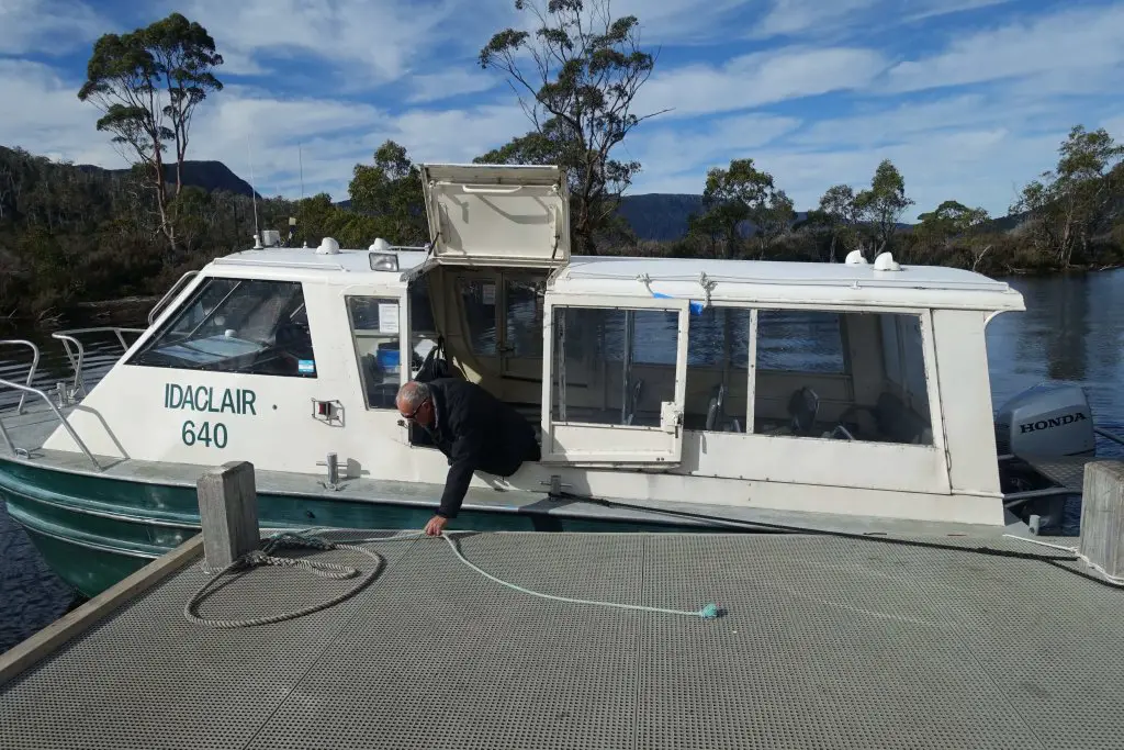
Radioing for the ferry
Beyond the usual bunks available at Narcissus Hut, the hut also houses the radio to call for the ferry to Cynthia Bay. We caught up with our ‘group’ of hikers and radioed for the ferry to pick us around 1. During peak season there are regular trips but as it was off peak, trips have to be arranged. Seems possible to either inform them before you start hiking, or radio at the end. But either way you’ll have to confirm when you reach Narcissus Hut for them to come. The radio is within the hut, just head in and the instructions are there. AUD50 per person or AUD300 per trip, whichever higher. We had 6 in the group, just sufficient to make it to the minimum price.

We had our lunch in the hut before heading over to the jetty. The jetty is about 5 mins further down from the hut. We arrived just in time for a few photos of the picturesque Lake St Clair before the ‘ferry’ arrived. Platypus have been spotted around so it may be a good idea to hang around.


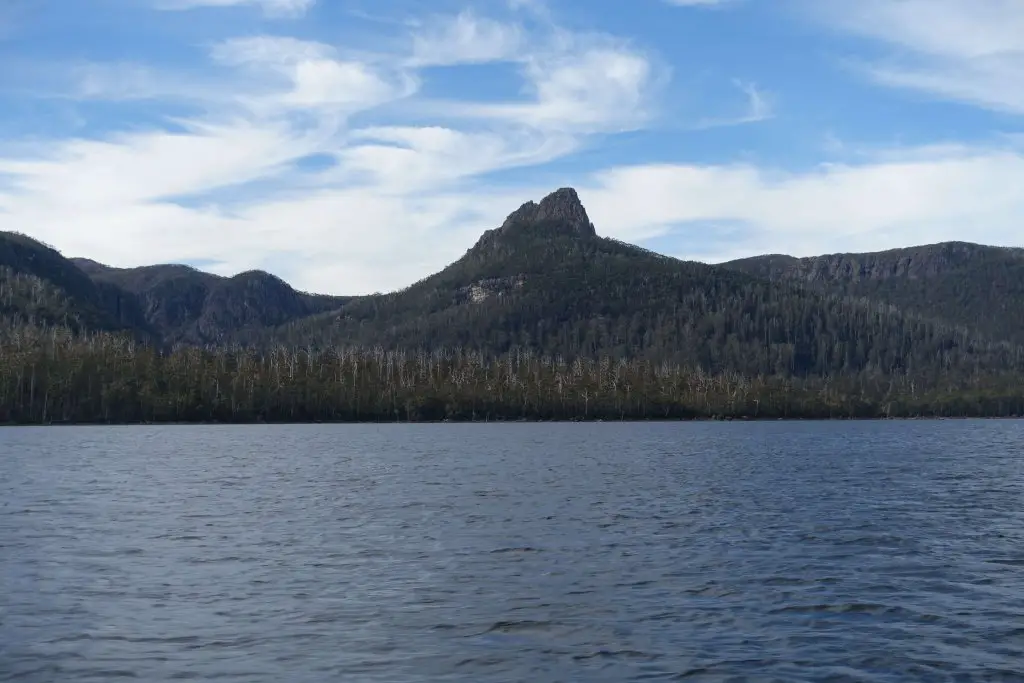
Lake St Clair is the deepest freshwater lake in Australia, with a maximum depth of 167m, and might be why the waters are so incredibly still.

Across Lake St Clair
The buzzing in the distance grew louder as our ‘ferry’ arrived, and a lively old man popped out and invited us in. While it could have been a direct ride out, he gave us a short tour of Lake St Clair, describing the surroundings, pointing out landmarks, and spun around twice near the middle so that we’d literally have a 360 (or should I say 720) degree view of Lake St Clair.

End of the Overland Track, Cynthia Bay
The ride out took about 40 minutes. I do enjoy long hikes, but at the end of all of them I still look forward to being back in civilization. Felt a wave of relief upon stepping on the jetty at Cynthia Bay that I’ve made it through another tough hike. It’s a complex mix of emotions at the end of every hike – relief, joy and sadness. A part of me glad that I’m done, the other looking forward to the next one.


At Cynthia Bay visitor center there’s a corresponding Overland Track signboard, similar to the one on the other end at Ronny Creek. Another obligatory photo before heading to the visitor center to check out souvenirs, more information about the Overland Track environment (would have been nice to see a little of that before starting), and sign out of the walk. There’s also a restaurant on the site (where we paid for our ferry rides with credit cards) to grab your first properly cooked meal in a week, and also some showers.

The final challenge, getting back to civilization
As we were hiking off peak (in May), there were no regular services to Launceston or Hobart. If you’re traveling in a big group or if you’re traveling during peak hiking season it’ll be easier to arrange/ get transport to either. Fortunately the rest of our ‘group’ had requested transport from Overland Track Transport departing that day, before the start of the hike. That was also why we had to make it out on exactly the day we did, as there was no transport scheduled/ booked for the day before and after. The reception confirmed that there were no other trips to Hobart, so we got on the van to Launceston and headed back to civilization.
Back in Launceston, our impromptu group of hikers decided to meet up for one last time for dinner at Patchinko. A little pricey, but a nice experience and good food, the perfect way to round up our 6 day friendship forged through sweat, rain, sunshine and animal encounters.
Up next, continuing the Tasmanian adventure with a half day in Launceston, before moving on to Hobart!


